Archive for the ‘Newfoundland2008’ Category
Posted by derrick on
July 20, 2008

N49 57.8 W55 36.17 La Scie Harbour. 90K. Open water crossing from Bell island to Baie Verte Peninsula. Crossing took 15 hours plus an extra hour to find a place to land. Glassy sea until afternoon then slugged it out with strong headwind.
Posted by derrick on
July 19, 2008

N50 57.53 W55 50.93 Pilier Bay at Cape Rouge. 45K. Interviewed by local newspaper prior to launching. Crossed Hare Bay. Persistent headwinds reduced forward speed to 2.5knots or less. Camped close to sea caves & arches. Will explore them tomorrow.
Posted by derrick on
July 18, 2008
N51 18.3 W55 38.18 Goose Cove. 58K. Early fog burned off leaving blue skies but moderate headwinds. Many whales, also saw my first sunfish its tall fin flopping lazily from side to side. Aborted plans to cross Hare Bay due to strong headwinds & confused seas. Got off water just ahead of rain and thunderstorms. I knocked on a door asking permission to put up my tent on a grassy spot and ended up being hosted by Ed who treated me to a Cod dinner and Capt’n Morgans rum!
Posted by derrick on
July 17, 2008
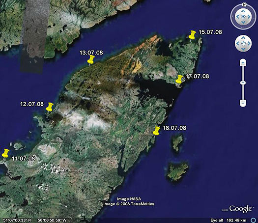
Enjoyed my day as a tourist. I recall the L’Anse aux Meadows site as being described as “desolate” but I found it strikingly beautiful. It reminds me a bit like Greenland, a green grassy plain surrounded by hills & the sea. Invited to a party with plenty of country music, beer,singing, dancing & laughter. These people certainly know how to enjoy life! Already looking forward to being on the water & pushing hard tomorrow.
Posted by derrick on
July 16, 2008
N51 36.07 W55 32.24 L’Anse aux Meadows. 85K & poised to round the Northern peninsula. 13hrs on water. Dim fog until crossed Pistolet Bay then turned sunny. Windy with a lumpy sea. Beautiful crossing of Sacred Bay with setting sun painting the world crimson. Will relax as tourist tomorrow & explore Viking site. I have wanted to visit here since grade school.
Posted by derrick on
July 14, 2008
Weather day. Wind blowing in right direction but howling at 40mph plus making even walking difficult at times. Most fishing boats stayed in
port today. Good to have shower & salt streaked clothing laundered. Still no cell coverage or internet access. Winds expected to drop tomorrow
Posted by derrick on
July 14, 2008
N51 23.0 W56 34.7 Green Island Cove. 51K. Fair winds but strong current slowed progress. Sleeping in huge fishing shed. ATVs buzzing outside.
Posted by derrick on
July 13, 2008
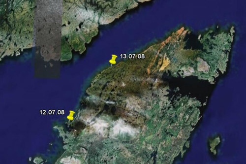
N51 03.0 W56 58.3 Dog Cove. 60K. Beautiful warm sunny day light winds. GPS & compass didn’t jive today. Later found that cans of salmon under deck (below compass) were the culprit. Labrador coast in sight! Thunderstorms off Labrador are booming in the distance. Close encounter with Fin whale. Camped in lovely meadow but mosquitoes out in force.
Posted by derrick on
July 12, 2008
N50 43.0 W57 22.1 Port au Choix on Pointe Riche Peninsula. 60K. Strong winds from SW building to F7. I had my hands full at Pointe Riche with an almost fully developed sea with large 8 to 10 foot rollers. Big stuff but waves not feeling bottom so few breakers but kayak decks often awash. Camp in protected harbor near Phillip’s Garden a 2400 year old Paleo Eskimo site.
Posted by derrick on
July 11, 2008

N50 14.42 W57 35.39 Daniel’s Harbour. 73K. Blustery following seas. Sunny most of day. Favorite moment: heavy rain matted down sea while large rollers from behind surged me forward, staying warm and dry in drysuit/kayak. Fisherman saw me come ashore & is letting stay in his shed. Rain & wind is howling loudly outside.


